
Chino Hills State Park
Chino Hills State Park is over 14,000 acres and over 90 miles of roads and trails. It features rolling hills, grasslands, oak and sycamore groves and seasonal streams. You can hike throughout the park. And mountain biking and horseback riding is allowed on most of the roads and trails. The bird watching is outstanding especially near the streams.
About The Park
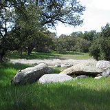
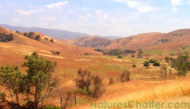
Because Chino Hills State Park is a fairly large open lands area with many rolling hills, it offers you many wonderful vistas. It also reflects the seasonal changes giving a wide variety of colors throughout the year.
Wildlife In The Park
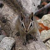
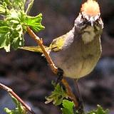
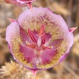
The areas adjacent to the seasonal streams support several varieties of wildlife. Birds are especially numerous along the streams. And when I say numerous, I'm referring more to variety as opposed to high counts of a single species. On one of our better outings, through Upper Aliso Canyon, we saw several species on the way up - and we saw several DIFFERENT species on our return! Some of the birds we have observed in Chino Hills State Park include: Golden Eagle, Blue Grosbeak, Yellow-Breasted Chat, House Finch (but a YELLOW variant!), Common Yellowthroat, Red-Tailed Hawk (of course - they're everywhere), Red-Shouldered Hawk, Great-Tailed Grackle, Yellow Warbler, Bluebird, Lazuli Bunting and Savannah Sparrow.
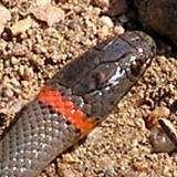
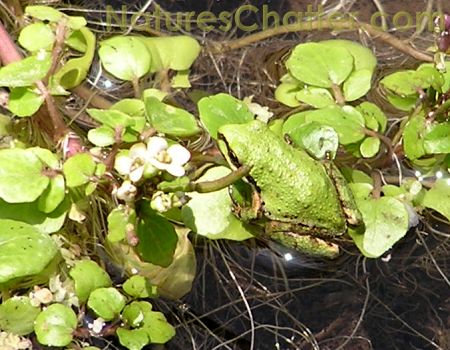
We've also observed the Baja CA Treefrog in one of the late season streams in a N/E tributary canyon that feeds into the Upper Aliso Canyon. We almost missed them as they can blend in very well with their surroundings. For a list of more sightings in this area, you can view our Sightings and Observations Log and search on "Chino Hills State Park".
Mountain Biking In The Park
There are approximately 60 miles of fire roads and trails within Chino Hills State Park. Mountain Biking is permitted on most of these roads and several of the trails. Their website offers a comprehensive assortment of useful Chino Hills State Park Trail Maps and Brochures that include topography and clearly define where riding is permitted. You may want to download and review these maps to select a ride that fits your skill level.
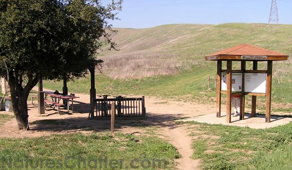
A great beginner ride would be the Telegraph Canyon Trail. You enter from the Carbon Canyon side of the park (you can park at the Chino Hills State Park Discovery Center for a small fee). The ride is a gradual incline for approximately 5.5 miles. At that point you will reach a saddle called "Four Corners". There is a picnic table and an information board. Take a breather, have a snack, take some pictures and then head back down the way you came. The 5.5 mile downhill ride back is a lot of fun and seems to go on forever. There may also be a portable toilet at Four Corners - but note that the portable toilet can be temporarily removed due to lack of serviceability during the Bane Canyon entrance closure.
For a more strenuous ride, take the North Ridge Trail heading up to Gilman Peak. This is a 3.75 mile moderately steep ride to the second highest point in the park. There are several great viewpoints along the way. When the weather is favorable you can see the ocean. I've been told you can also see the Hollywood sign from Gilman Peak. We observed several raptors and other wildlife along the was. But note that this is a very exposed trail and I would not recommend this ride on a hot summer day. Also watch out for the cow piles - we dodged several (no cows though).
Maps and Directions for Chino Hills State Park
Access via the Bane Canyon entrance, on the northeast side of Chino Hills State Park, can be subject to closure at any time due to road construction. For current status, visit the Chino Hills State Park home page. Alternatively, you can enter Chino Hills State Park from the northwest side at the Discovery Center which is located near Brea. View Google Map to the Chino Hills State Park Discovery Center for directions. To help you navigate your way through the park you can download Chino Hills State Park Trail Maps and Brochures from their website describing the trails, roads and campground. Note that the campground is currently closed - this is also related to the Bane Canyon closure.
Updated: December, 2013